Situación Geográfica
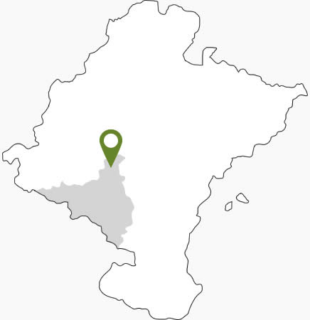
Larraga es un municipio que se encuentra en el centro de la Comunidad Foral de Navarra, en la Zona Media o Ribera Alta

LARRAGA
Coordenadas: 42°32′51″N 1°51′17″O
Larraga (1) es un municipio que se encuentra en el centro de la Comunidad Foral de Navarra, en la Zona Media o Ribera Alta. Limita al norte con Mendigorría, al nordeste con Artajona, al sur con Berbinzana y Miranda de Arga, al suroeste con Lerín, al este con Tafalla y al oeste con Oteiza de la Solana y Baigorri. Su término municipal tiene una extensión de 77,201 km2, ocupando el vigesimonoveno puesto entre los ayuntamientos de Navarra en cuanto a extensión municipal.
En el área administrativa tiene la categoría de municipio y pertenece a la Merindad de Olite, mientras que en lo jurídico tiene un Juzgado de Paz propio y forma parte del Partido Judicial de Tafalla.
Límites:
- Al norte, con Mendigorría.
- Al nordeste, con Artajona.
- Al sur, con Berbinzana y Miranda de Arga.
- Al suroeste, con Lerín.
- Al este, con Tafalla.
- Al oeste, con Oteiza.

